About Locations
Table of Contents
Overview
Locations give you the ability to link different Procore items (e.g., RFIs, Submittals, and more) to specific locations on a job site. This helps project team members to identify the exact location(s) on a job site where a defect was observed, where materials are to be installed, or where a project change order occurred.
Historically, you could manually create or import your locations. These options are still available. A new enhanced Locations experience is designed to leverage the latest AI technology to automatically generate a locations hierarchy based on your project's architectural drawings.
You can view locations in the Locations screen throughout the life of your project to easily see and access items associated with each location. Locations are accessible through the Project level Admin and Drawings tools.

Considerations
Details
With Locations, you can take the following actions:
- Generate locations hierarchy from drawings
- Import locations
- Manually create locations
- Generate and print QR codes for locations
- View a heat map of items associated with locations
- View all items related to a location
generate a locations Hierarchy from architectural drawings
With the new Locations experience, you can use your Architectural plans in Procore to automatically generate your locations hierarchy. Select which drawings to use to create your hierarchy of locations, review the locations and modify them if needed. Each location shows a boundary around the location's area on your drawing. See Generate Locations Hierarchy From Drawings.
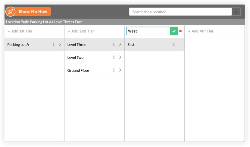
Manually Create Locations Hierarchy
Manually create your locations hierarchy and set preferences for your users to create locations from other tools in Procore.
See Manually Create Locations Hierarchy and Allow or Disallow Users to Create Locations within a Tool.
Import Locations
Import locations from other systems outside of Procore. You can import locations in the following ways:
Generate and print QR codes for locations
Generate and print location QR codes and post them at each location at your job site. Users in the field can scan the QR code using the Procore Mobile App to either filter by the location identified in the QR code or create an item in Procore with that location linked. See Generate and Print QR Codes for Locations, Scan a QR Code to View an Item (iOS), and Scan a QR Code to View an Item (Android)
View a heat Map of Items Associated with Locations
Note: The heat map is only available for locations generated from drawings.
When you generate locations from drawings, you can view a heat map of items associated to locations. This heat map helps you see which areas have higher activity relating to RFIs, Submittals, and more. A darker color indicates a higher number of total items linked to that location.

View all Items Related to a location
When viewing your location hierarchy, you can click a location to view a list of all items associated with that location. See View Item Locations.
